make.new_water
make.new_water will modify an initial topobathymetric surface to add new water areas. This may be of use in areas that have experienced recent deglaciation or lakes with incomplete bathymetric observations. The following is typical usage for make.new_water.
Prepare a topography file as a geotif.
Prepare or obtain a shapefile containing one or more polygons indicating the areas for which new water is desired.
Estimate the maximum water depth for new water and the side-slope angle to use near the shoreline between sea level and the maximum new water depth. Ensure that the geotif and shapefile have the same coordinate system.
Run
make.new_waterto modify the topobathymetry file. Inspect the output and adjust any input parameters as needed.Depending on the use case, this function may be run before or after other
digger.makefunctions to set up the initial conditions for a D-Claw simulation.
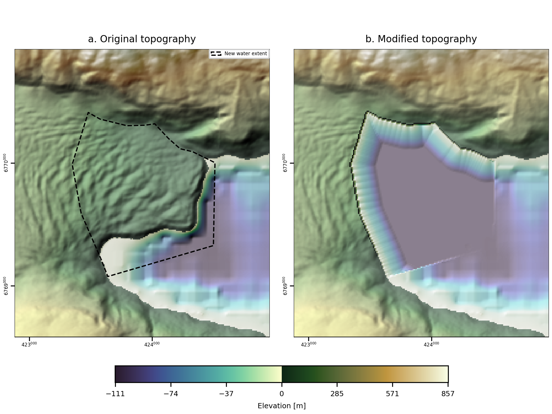
A code snippet that uses make.new_water may be found in the file digger/examples/pre-run/harriman_fiord/make_new_water.py. In this example, deglaciation has exposed additional water.
"""Example using digger.make.new_water.

This example makes new water in an area where glacial retreat has occured.
"""

from digger import make

make.new_water(
    topo_path="../../../data/harriman_fiord.tif",
    new_water_path="../../../data/hypothetical_new_water.shp",
    water_depth=110.0,
    side_slope_angle=30.0,
    sea_level=0.0,
    west=422883,
    south=6768582,
    east=424957,
    north=6770923,
)
Attention
This code snippet is not fully self-sufficient. To reproduce the example, execute the code such that the relative path is correct. This may be done by executing the example script from within the directory in which it is located.
After this code runs, it will produce geotif and topotype3 files that specify the modified topobathymetry.
It will also create diagnostic figures to assist the user in refining the failure surface generated through make.new_water.

Fig. 7 An example of the diagnostic output provided by digger.make.new_water.